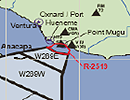
 The waters from Point Conception to the Mexican border and out 200 miles are heavily used by the U.S. Navy for air, surface and sub-surface operations including training exercises/maneuvers and live fire demonstrations. This is on top of heavy commercial maritime traffic to/from the ports of Los Angeles/Long Beach and San Diego, commercial and sport fishing activity and recreational boat traffic. It is not uncommon for oceanographic work in the Southern California Bight to conflict with scheduled naval operations.
As necessary, the SIO Ship Scheduling Office will advise appropriate naval commands and units of scheduled SIO vessel activities. Advisories contain:
- A brief description of the operation or work to be performed;
- Location(s);
- Dates and times (start and end of operations);
- Other pertinent details as appropriate including:
- Frequencies or frequency ranges of active sonar;
- Equipment that will be left on site (bottom-moored instruments, moorings, buoys, drifters, AUVs, etc.) and anticipated recovery dates.
If a conflict is identified, the SIO Ship Scheduling Office will work with the affected scientific group and the Navy to resolve. Solutions can range from adjusting time lines to selecting alternative work sites; each case is unique.
SIO sends advisories to the Navy one to two weeks prior to the start of each operation. If you plan to work in the Southern California Bight, you should submit your cruise plan to the SIO Ship Scheduling Office at least three weeks prior to the start of your cruise. Your cruise plan will be posted on the SIO Ship Portal, along with other information about your cruise. All of this information will be used by the Ship Scheduling Office to generate advisories to the Navy.
San Clemente Island
The area around San Clemente Island experiences a significant amount of Navy activity. The impacted areas are shown and described at www.scisland.org, which also describes Navy activities for the next seven to ten days.
If you plan to work in the waters around San Clemente Island, contact SIO Ship Scheduling at least two months in advance, so that we may deconflict your work with the FASFAC SD (Fleet Area Control and Surveillance Facility, San Diego).
Local Notices to Mariners
If your scientific operations may affect or interfere with marine traffic in any way, you should be submit your work plan to the U.S. Coast Guard for publication in their weekly Local Notices to Mariners.
Local Notices to Mariners are widely distributed in maritime circles and are the best way to let the shipping and boating public know of your operational requirements and/ or equipment locations.
Your submittal should be completed at least two weeks before your operations. Contact SIO's SIO Ship Scheduling Office to determine if your operation requires a Notice to Mariners. Guidance from the U.S. Coast Guard publication in the Local Notice to Mariners is available online:
https://www.pacificarea.uscg.mil/Our-Organization/District-11/Prevention-Division/LnmRequest/
Permits for research buoys
The installation of oceanographic research buoys requires a permit. Research buoys are considered Private Aids To Navigation (PATON) and as such are regulated by U.S. Coast Guard under Title 33 of the Code of Federal Regulations, Part 66 (33CFR66). Detailed information can be found online: scripps.ucsd.edu/ships/policies-and-procedures/uscg-rules-buoys
Questions regarding naval advisories and notices to mariners can be referred to the SIO Ship Scheduling Office at (858) 534-2841 or shipsked@ucsd.edu. The Ship Scheduling Office can also assist with obtaining clearance/concurrence to work in other Navy operational areas as well.